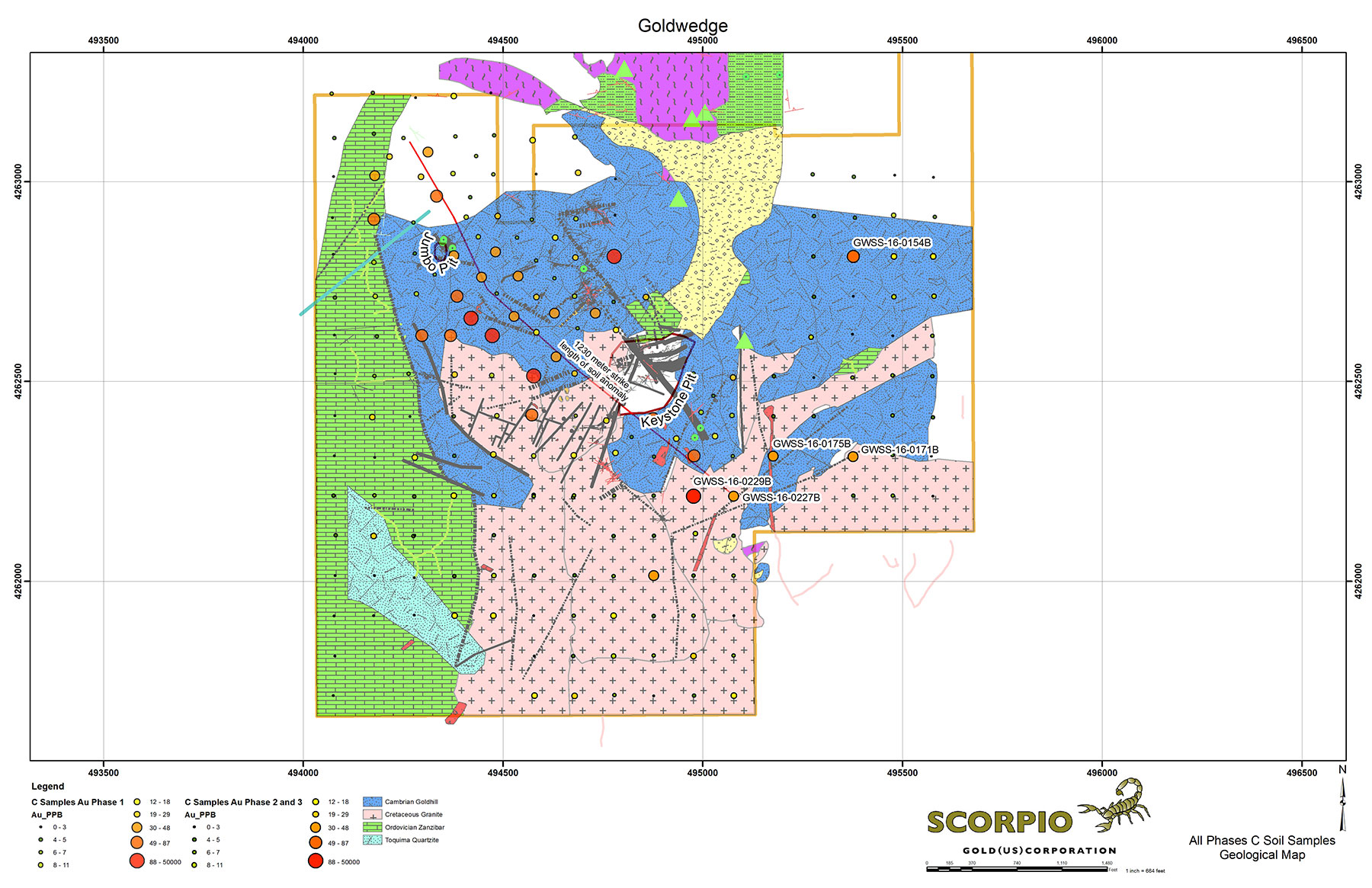
The Keystone-Jumbo project area is located ~4 km southeast of the Goldwedge deposit and mill, and along strike of the regionally significant N30W trending Reliance fault zone, which trends through Goldwedge and the Manhattan Mine East and West pits. Geologically, the Keystone and Jumbo deposits occur near the northern margin of a Cretaceous granite intrusion within limestones, argillites, quartzites and schists of the Cambrian Gold Hill Formation. Mineralization is controlled by high-angle N30W faults transected by a weaker N30E and N80E structural fabric. Intersections of these fabrics control the high-grade gold mineralization in the historic Keystone and Jumbo pits.
The gold itself is localized within fault breccias and silicified metasediments in the Keystone and Jumbo pits as well as oxidized quartz-pyrite-gold veinlet stockworks in the clay alteration halos surrounding the core of the known mineralization. Hydrothermal alteration/mineralization affects the Mesozoic granites and some low-volume younger volcanics, suggesting that the age of the gold bearing system is mid to lateTertiary and may be genetically related to the Round Mountain-Toquima caldera complex.
Limited historic surface drilling at Keystone reported substantial downhole widths and grades, leading Nevada Goldfields to undertake a small open pit excavation in 1990 that recovered 5,750 ounces of gold. A preliminary review of the available data indicates that significant drill intercepts lie below and to the southeast of the open pit. A small open pit was also excavated around the same time on the Jumbo deposit. New Concept Mining reported mineral resource estimates for both the Jumbo and Keystone deposits in May 1997; however, neither estimate is compliant with NI 43-101 and await verification.
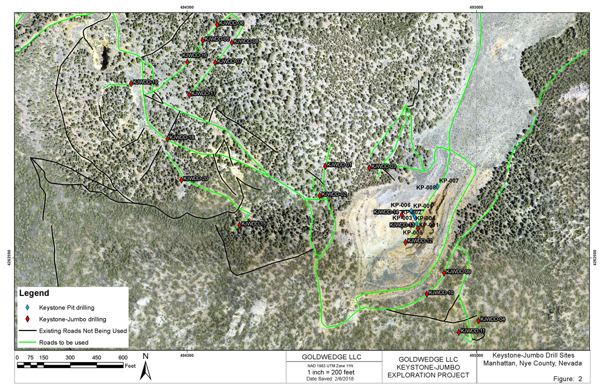
2019 Exploration Drilling Program
Scorpio Gold conducted a first-phase exploration diamond drilling program in the Keystone-Jumbo area in mid 2019. Nine exploration holes totalling 628 meters were drilled to test an area of previously reported surface soil sampling anomalies as well as structures relating to historic mineralization within the Keystone-Jumbo claim block (see 2016 program below and December 15, 2016 news release). Drill hole KP19-DDH-01 was collared within the Keystone pit to test the intersection of two high-angle NW and NE trending faults. The hole intersected mineralized polymictic breccia for its entire 19.2 meter length and returned 2.18 g/t Au over 14.63 m (December 6, 2019 news release). Visible gold was noted in silicified breccia and fractured quartzite within hole KP19-DDH-03 (photo); however, assay results were negative for gold in the samples taken. Results of the drilling have provided valuable new information on the controls to mineralization in the area and a second phase of drilling is planned.
2016 Exploration Program
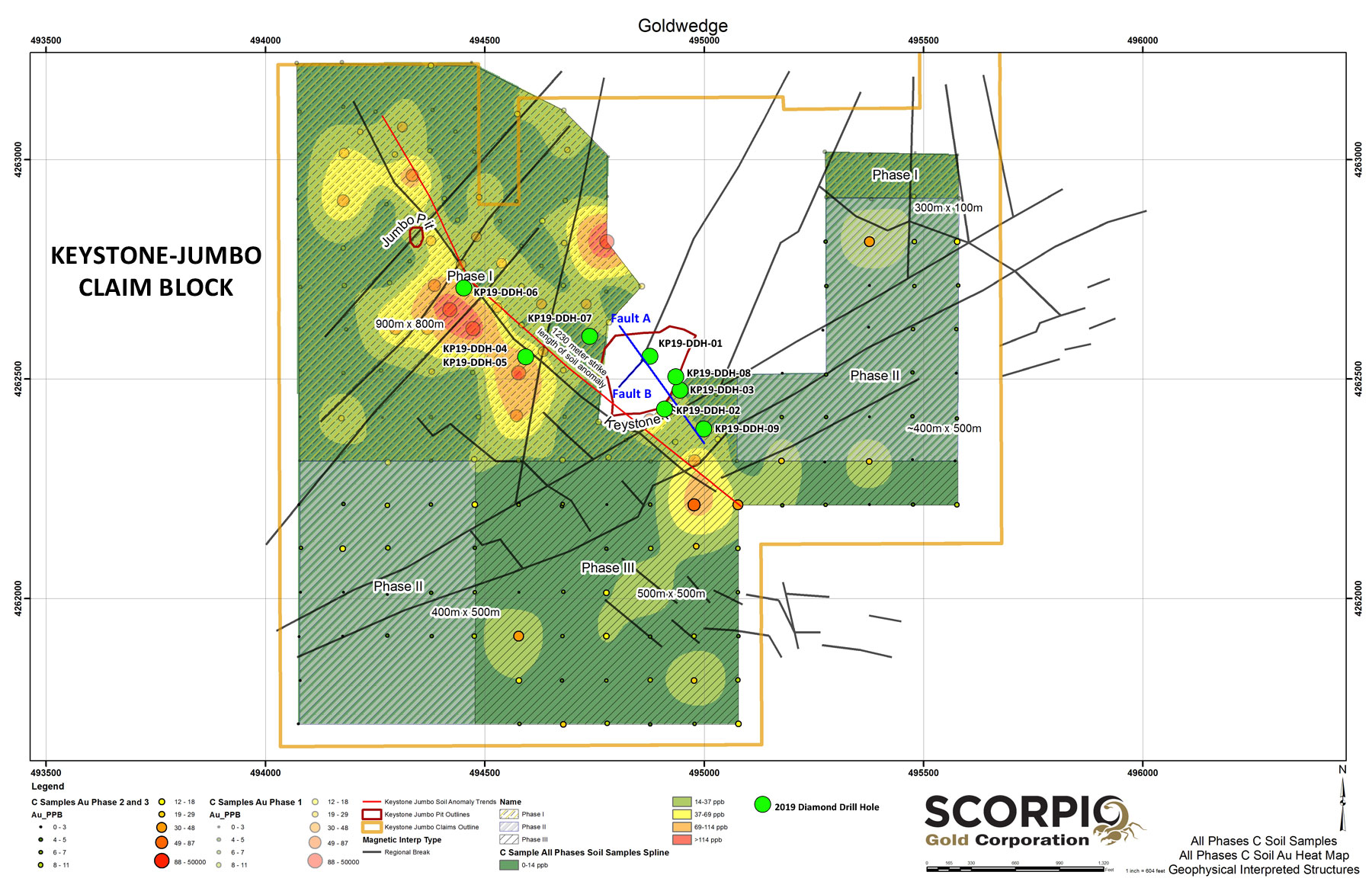
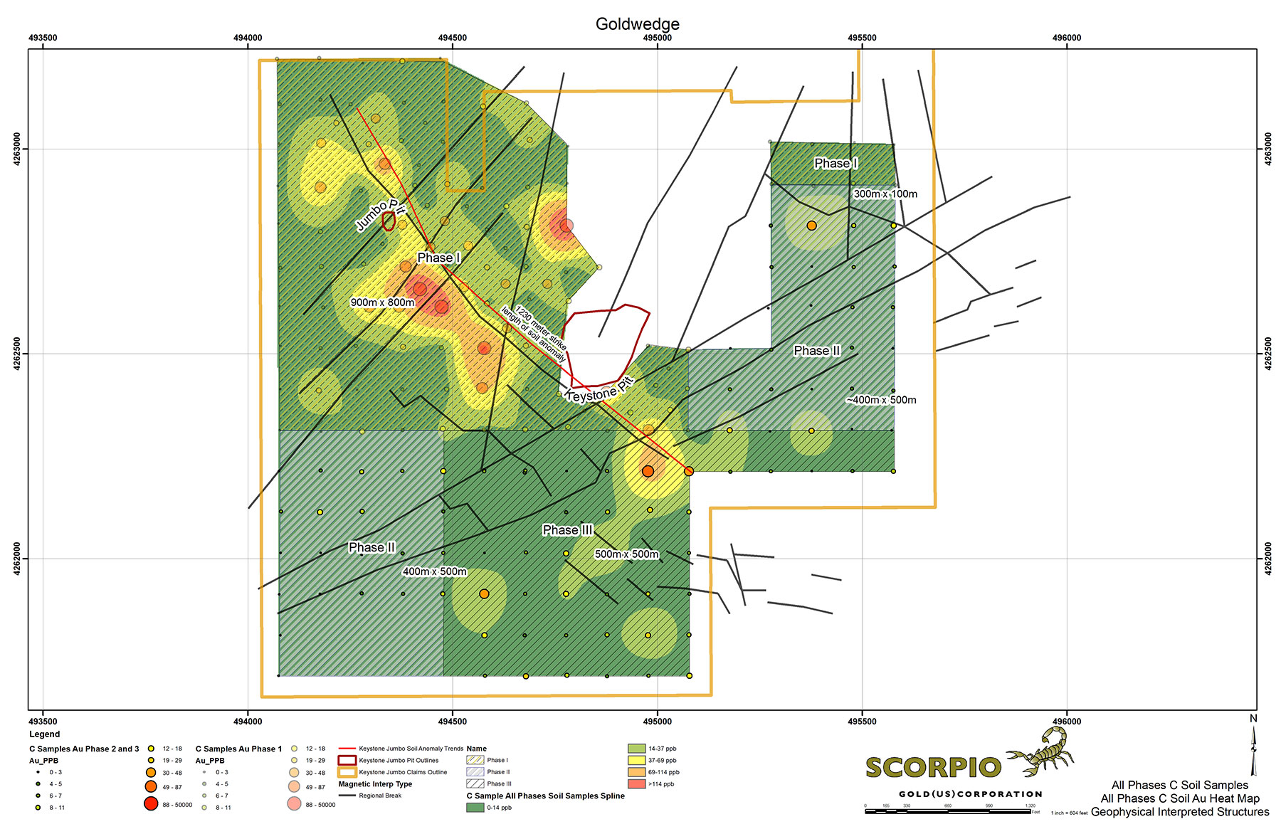
Scorpio Gold completed a soil sampling program and ground magnetic/VLF electromagnetic survey over the Keystone-Jumbo project area in mid-2016. The geophysical survey was designed to assist in structural interpretation of the area and the soil sampling program to detect anomalous gold mineralization in areas covered by overburden. In the Keystone-Jumbo area, overburden covers approximately 85% of the land position and typically ranges from 0 to 2 meters depth.
Results outlined a 1,230 meter long soil anomaly that crosses nearly the entire NW length of the Keystone Jumbo land holdings. The anomaly follows a distinct N30-45W trending structural break that is sub-parallel to the N30W structure mapped in the Keystone pit, which is determined to be the main structural control to mineralization (see November 14, 2016 and December 15, 2016 news releases).